(Update: voting has closed)
This holiday season, I'm excited to invite you to help decide which location to feature as a topographic map in my upcoming collection! Your input is indispensable, and as a thank you, voters who choose the winning location will be entered for a chance to win $20 off the finished map, just in time for Christmas.
But hurry—voting will conclude on Sunday, October 27th, and I don't want you to let the sun set on this opportunity when we set the clocks back! So, grab your favorite mug of cocoa, cozy up, and cast your vote before the weekend is over.
Here’s My Shortlist of Parks to Choose From:
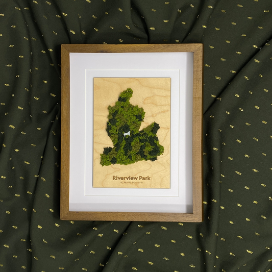
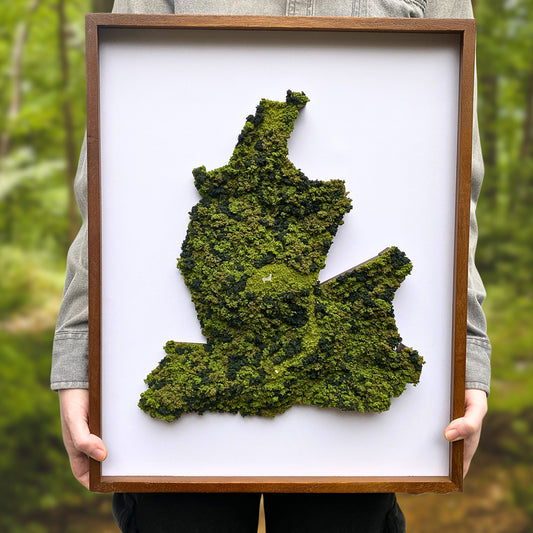
1. Riverview Park <<Winner!

Coordinates: 40.482°N, 80.019°W
Established in 1894, Riverview Park is a breathtaking green oasis located in Pittsburgh’s North Side, encompassing approximately 259 acres. The park is renowned for its dense woodlands, steep hills, and stunning vistas of the city and the Allegheny River. Its natural beauty and rich history have made it a cherished destination for locals and visitors alike.
One of Riverview Park's standout features is its connection to the historic Observatory Hill neighborhood, founded the same year. The neighborhood showcases striking architecture and spacious homes, reflecting a variety of styles from Victorian to modern designs. It offers spectacular views of the Pittsburgh skyline and surrounding hills, creating a picturesque setting that is steeped in history.
The park also houses the Allegheny Observatory, a landmark institution dedicated to astronomical research since 1859. Visitors can explore the wonders of the night sky through public programs, making it a popular spot for those curious about the cosmos. In addition, the park features several trails, including the popular Riverview Loop, a two-mile path that meanders through the woods, perfect for hiking, jogging, and simply enjoying nature.
Riverview Park's history is deeply intertwined with the development of Pittsburgh itself. Initially established to preserve the natural landscape in the wake of rapid urbanization, the park has maintained its historical significance over the years. The Chapel Shelter, a restored historic picnic shelter that once served as a Presbyterian church, is a testament to the park’s commitment to preserving its cultural heritage. This restoration project, completed in 2008, included the creation of new trails and the planting of native trees and shrubs, ensuring that the park continues to thrive.
For those who appreciate the outdoors, Riverview Park offers an array of recreational opportunities, including a swimming pool, playgrounds, sports fields, and seasonal events such as concerts and movie nights. The park's diverse habitats support various wildlife, making it a great spot for birdwatching and nature photography.
A layered wood topographic map of Riverview Park would highlight its stunning topography, showcasing the park's steep hills and deep valleys. The Mairdale watershed and its surrounding landscapes could be prominently featured, illustrating the natural drainage patterns and diverse ecosystems within the park. Elevation changes, particularly around the observatory and lookout points, would emphasize the park's scenic views of the Allegheny River and the Pittsburgh skyline, providing a tangible connection to the geography that makes Riverview Park such a unique escape.
2. North Park

Coordinates: 40.604°N, 80.007°W
Established in 1927, North Park is the largest park in Allegheny County, spanning an impressive 3,094 acres. This expansive outdoor destination offers numerous recreational opportunities, including North Park Lake—the largest man-made lake in the county—ideal for fishing, boating, and enjoying stunning scenery.
The park features a five-mile paved trail that circles North Park Lake, attracting fitness enthusiasts and nature lovers alike. As you follow the trail, you’ll be treated to beautiful views of the lake and its diverse habitats, which host a variety of wildlife, including birds, turtles, and mammals.
Another gem within North Park is the Latodami Nature Center, a 250-acre area featuring diverse landscapes such as fields, forests, wetlands, and ponds, all interconnected by inviting nature trails. The center provides guided programs year-round for visitors, schools, and private groups, encouraging exploration of the region's rich wildlife and ecosystems.
North Park is steeped in history as well. It once featured a Game Preserve on Flagstaff Hill, where bison roamed under the care of a family from the Blackfeet Nation. The park hosted a Civilian Conservation Corps camp during the Great Depression, which contributed many of the trails and structures still in use today. For those looking to cool off in the summer, the North Park Pool, once one of the largest in the world, holds two and a half million gallons of water and continues to draw visitors. Golfers can enjoy the North Park Golf Course, established in 1928, which remains a favorite spot for both beginners and seasoned players.
Having a topographic wood map of North Park displayed at home keeps the spirit of your outdoor adventures alive. It serves as a visual reminder of your favorite trails and lakes, allowing you to retrace your steps and recall special moments spent in nature. The map can spark ideas for future explorations, guiding you to discover hidden gems you might have missed. Plus, its natural aesthetics add character to your space, making it a unique conversation starter that reflects your love for the outdoors. It invites guests to share their own outdoor stories, creating a bridge between your experiences and theirs.
3. Deep Creek State Park

Coordinates: 39.530°N, 79.366°W
Deep Creek State Park, established in 1971, is a stunning natural retreat nestled in the western mountains of Maryland. Spanning over 3,900 acres, this park offers a variety of recreational opportunities and breathtaking landscapes for visitors to enjoy year-round.
One of the park's standout features is Deep Creek Lake, Maryland's largest freshwater lake, which covers an impressive 3,900 acres and boasts over 65 miles of shoreline. The lake is a popular destination for fishing, boating, and swimming, making it a prime spot for outdoor enthusiasts. The park also features numerous picnic areas, hiking trails, and campgrounds, providing ample opportunities for families and friends to gather and enjoy the great outdoors.
The Indian Turnip, Lookout, Brant Mine, Beckman's, and Meadow Mountain Loop is a continuous trail in Deep Creek State Park that showcases the park’s diverse topography. This hike features moderate to steep inclines, leading to beautiful views, especially along the Lookout Trail. The route descends into rocky valleys and climbs back up through lush forests, offering a range of elevation changes. Hikers can enjoy both challenging sections and easier slopes, making this loop a great way to appreciate the park's unique geological features and natural beauty.
Historically, the area surrounding Deep Creek State Park is rich with heritage. The region was once inhabited by Indigenous tribes such as the Seneca, Shawnee, and Delaware. Remnants of their presence can still be found throughout the park, illustrating the rich cultural tapestry of the area. In the 1800s, settlers began to be drawn to the natural beauty and abundant resources. The establishment of Deep Creek State Park was part of a broader effort to preserve the unique landscapes and recreational opportunities in the region, allowing future generations to appreciate the beauty and history of this remarkable area.
In addition to its natural beauty and historical significance, Deep Creek State Park is also a hub for various seasonal activities. In the winter, visitors can enjoy cross-country skiing and snowshoeing, while warmer months offer opportunities for hiking, biking, and wildlife watching. The park is home to diverse wildlife, including deer, wild turkeys, and various bird species, making it a great spot for nature lovers and photographers.
Imagine seeing this unique landscape hanging on your wall, with a map showcasing the changes in elevation and surrounding lush forests. The map would invite viewers to envision their own journeys through the park. Visualizing Deep Creek Lake on the map would offer a striking contrast, illustrating its expansive shoreline and recreational areas. The unique topography of the area, including its hills and valleys, would not only make for an attractive art piece but also inspire a sense of exploration and adventure.
Pitch an Other

Coordinates: ??.???°N, ??.???°W
In addition to voting for one of the featured parks, you have the exciting option to select "Other" and propose your own location! If you choose this path, I encourage you to include a short pitch explaining why your chosen spot should be prioritized over the others. This is your chance to champion a special place that holds meaning for you and to help shape the direction of my collection! Keep in mind that I’m currently focusing my sales on customers based out of Southwest Pennsylvania. The other people voting will be in this area. I plan to expand my offerings in the future and depending on how this experiment goes I hope to have more votes in the future!
Why Your Vote Matters
Now, more than ever, your vote is crucial in shaping the future of my map lineup. As I consider the requests I've received over the years, I want to ensure that the final selections resonate with you and reflect the stories and places that matter to our community. Each map I create serves not only as a work of art but also as a connection to the places we love and cherish.
Your participation not only influences my work but also fosters a sense of community. By sharing your preferences, you’re not just voting; you’re joining a collective effort to celebrate the unique landscapes that surround us. I can’t wait to see which park resonates the most with all of you!
As an important reminder, I can and do make custom maps of ANYWHERE. If there’s
The Many Facets of a Solopreneur
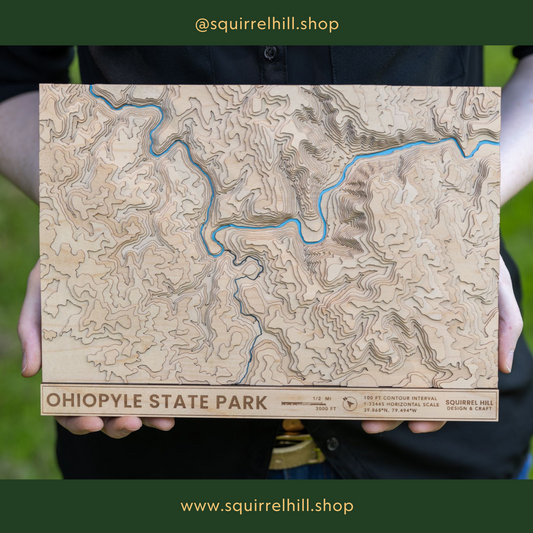
As a 30 something artist and solopreneur running my business in Pittsburgh's East End, I pour my heart and soul into creating highly detailed, handcrafted layered wood maps. These maps focus on elevation, water, and park boundaries, capturing the essence of our beautiful landscapes. It’s a labor of love, and each piece tells its own unique story.
Being a one-woman show means I juggle numerous tasks daily. From crafting the art and managing intricate cartography to designing my website, handling bookkeeping, and marketing my pieces, every aspect of my business falls on my shoulders. It’s an exhilarating ride, but it can also be overwhelming. I handle customer inquiries, manage social media platforms, and engage in networking to expand my reach. Each map I create reflects my passion and dedication to artistry, and that commitment is evident in every detail.
Often, I participate in local events where I get the chance to meet fellow map enthusiasts. It’s during these events that I receive many requests for custom maps, showcasing the interest and enthusiasm people have for their own locales. However, due to my limited capacity, I can’t accommodate every request. While I genuinely wish I could create maps of every requested location, the reality is that my time and resources are finite.


1 comment
University Park